Richard J. DeMarco, AIA discusses Flood Mitigation in The New York Times series on Disaster Mitigation
Everyone talks about extreme weather. (Or denies it.) But many people are also doing something: designing and constructing flood-resistant buildings and infrastructure. The New York Times is presenting case studies that highlight how the built environment is being made more resilient in New York City and other nearby coastal areas.
“You’ve got to think like a marine architect,” said Richard J. DeMarco, a principal in Montroy DeMarco Architecture, which has workedin West Chelsea, a flood-prone area of Manhattan.
Here are terms you are likely to encounter as The Times explores ways to ensure that homes, workplaces and communities can better withstand and recover from storms.
100-YEAR FLOOD PLAIN
This isn’t as benign as it sounds. It means an area that has a 1 percent chance of flooding in any given year — not an area that will flood only once in a century. Several 100-year floods may follow one another in rapid succession.
500-YEAR FLOOD PLAIN
An area that has a 0.2 percent chance of flooding in any given year.
APPENDIX G
A 2014 addition to New York City’s Building Code that regulates construction and substantial building improvement in flood hazard zones.
ARTICLE 6, CHAPTER 4
This provision in the New York City Zoning Resolution modifies requirements like building design and permitted obstructions to allow developers to meet resilient design standards.
A.S.C.E. 24
Design and siting standards set by the American Society of Civil Engineers for buildings and structures in flood hazard areas. The Federal Emergency Management Agency deems the A.S.C.E. 24 standards to meet or exceed the requirements of the National Flood Insurance Program.
BASE FLOOD ELEVATION (B.F.E.)
The height of flooding that might be expected in a 100-year flood. It is not measured from ground or sea level, but from a benchmark called the North American Vertical Datum of 1988. It can be found on flood insurance rate maps.
DESIGN FLOOD ELEVATION (D.F.E.)
In new or substantially renovated buildings, the minimum height at which residential units may be constructed and utilities like the boiler, the water heater and electrical equipment may be located. It also sets the minimum height for dry or wet flood-proofing measures for buildings generally. The margin between this and the base flood elevation is called freeboard.
DRY FLOOD-PROOFING
Under this design approach, buildings are made as watertight as possible through the use of impermeable materials and flood barriers. Its corollary is wet flood-proofing.
EVACUATION ZONES
These differ from flood zones. New York City has six hurricane evacuation zones, moving upland from the coast or shoreline, depending on the severity of the storm.
FEDERAL EMERGENCY MANAGEMENT AGENCY (FEMA)
Among its many responsibilities, FEMA, a unit of the Department of Homeland Security, runs the National Flood Insurance Program and issues flood insurance rate maps, showing where and what flood hazards exist.
FLOOD GATES, FLOOD LOGS, FLOOD PANELS
A growing number of buildings have installed the hardware needed for a temporary flood dam, given enough notice. (And there usually is enough with big storms.) Vertical posts are inserted into anchors in the pavement, then horizontal slats are stacked up between the posts. FEMA officials in the New York region cautioned that a large number of these kinds of protection systems failed during Sandy.
FLOOD INSURANCE RATE MAPS (FIRM)
These maps, produced by FEMA, are the go-to source for information on special flood hazard areas and base flood elevations. A map service center allows users to look up flood maps by address, place name or latitude and longitude. The location of boundaries between safe, moderately hazardous and hazardous zones has a huge impact on homeowners, landlords and developers. Preliminary maps, or Pfirm, exist for New York, but the city successfully challenged their accuracy. In 2016, FEMA announced a revision process that would create two new maps for the city; one guiding construction and renovation along the waterfront, the other affecting how much flood insurance homeowners will be required to carry.
FLOOD VENTS
Openings in a building facade that allow for the entry and exit of floodwater, allowing for the equalization of hydrostatic pressures. They are used in wet flood-proofing.
FLOOD ZONES
Flood insurance rate maps break riverine, coastal and shoreline areas into zones of special flood hazard. The designations can get very fine-grained, but the basic three levels are areas that are at risk of waves higher than three feet (Zone V), areas subject to 100-year floods (Zone A) and areas subject to 500-year floods (Zone X).
FLOODPLAIN
An area susceptible to inundation.
FREEBOARD
A safety margin, generally one to three feet, between a base flood elevation and the design flood elevation.
HYDROSTATIC PRESSURE
Besides the threat posed by moving water, structures built in an area with a high water table (at or near a waterfront, for instance) may be at risk of long-term damage from the pressure exerted by the water in the soil around them, which can crack concrete foundations.
LIMWA
Not the alternate title of “The Lion Sleeps Tonight,” but an acronym for limit of moderate wave action, as shown on the flood zone map above.
NATIONAL GEODETIC VERTICAL DATUM OF 1929 (NGVD29)
An outdated measurement benchmark, but you may come across it. This refers to what was once called the Sea Level Datum and was used until recently by the federal government for mapping projects. Its relation to the North American Vertical Datum of 1988 varies from place to place. In New York City, the new datum is generally 1.1 feet below the old datum.
NATIONAL FLOOD INSURANCE PROGRAM (N.F.I.P.)
Congress created this program in 1968 to reduce the cost of flood insurance premiums paid by homeowners, renters and business owners in communities that adopt and enforce floodplain management practices that meet or exceed federal standards. The program, run by FEMA, is more than $20 billion in debt and faces reauthorization this year.
NOR’EASTER
Cyclonic storms along the East Coast are so called because the winds blow from a northeasterly direction. They can bring heavy rain, snow, wind and flooding.
NORTH AMERICAN VERTICAL DATUM OF 1988 (NAVD88)
A base from which consistent height measurements can be taken throughout the United States, Canada and Mexico. These are not points in physical space, but a computed series of coordinates. They are far more precise than sea level, in part because the surface of the sea is not level. At the tip of Manhattan Island, mean sea level is about two-and-a-half inches below this datum. At the Washington Navy Yard, it is three-quarters of an inch above the datum.
OVERWASH
Waters carried upland, especially after surges, may be prevented by intervening structures from flowing directly back to the sea. This mass of water is called overwash.
RIVERINE
Related to a river.
SEA LEVEL RISE
Billions of tons of land ice are melting or sliding into the ocean. The sea is also absorbing most of the heat trapped by human emissions. Those factors are causing the ocean to rise at what appears to be an accelerating pace. Sea level rise increases the depth and extent of floods.
SPECIAL FLOOD HAZARD AREA (S.F.H.A.)
Where 100-year floods and damaging waves can be expected. It includes Zones V and A. It is based on surge levels in coastal and tidally influenced areas, and on large lakes.
STILLWATER ELEVATION
The height of coastal or tidally influenced floodwater, undisturbed by waves, from a given datum.
STORM WATER MANAGEMENT
Storm water runoff is not the same as a flood, though it can cause localized flooding. Most of New York’s sewers are combined, meaning they handle both storm water and sewage on its way to treatment plants. When too much rain water or melting snow and ice washes over impervious paving and into the sewer system, it can lead to overflows and the discharge of sewage and pollutants into surrounding waterways. Permeable paving, swales and dry wells can temporarily capture runoff and reduce combined sewer overflows.
SWALES
Areas of soil or absorbent material, like a bed of gravel, that are designed to trap storm water runoff and hold it until it can be safely emptied into a municipal storm sewer or into the soil. Bioswales refer to landscaped strips of plantings along sidewalks or buildings’ edges.
SURGE
An abnormal rise of water generated by a storm, as a result of atmospheric pressure changes and wind. They are especially damaging if water is already at high astronomical tide.
WET FLOOD-PROOFING
A method that allows floodwaters to pass through parts of a building without endangering structural stability. Wet flood-proofed areas can be used only for parking, storage or access, or as crawl spaces. The FEMA officials in the New York region said that wet flood-proofing,if employed correctly, could substantially reduce flood risk and lower flood insurance costs. The corollary is dry flood-proofing.
Source: The New York Times
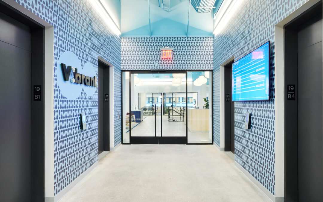
Vibrant Emotional Health’s Headquarters Receives 2024 Project Profile Award by Commercial Construction & Renovation (CCR) Magazine
Vibrant Emotional Health Headquarters, New York, New York Affiliate Designer: Montroy Andersen DeMarco, Contractor: Benchmark Construction The $10 million, two-story 60,000 SF office houses mental health and emotional counseling personnel, as well as all...

Morgan North Receives 2024 Honor Award for Excellence in Landscape Architecture
We are thrilled to announce USPS Morgan North's 2-acre Rooftop Landscape is the recipient of the American Society of Landscape Architects, New York Chapter's (ASLA-NY) prestigious "Honor Award". This award recognizes excellence in the practice of landscape...

NYREJ’s 2024 Women in Construction Spotlight: Jessica Gross, Associate AIA & WELL AP
New York Real Estate Journal's 2024 Women In Construction: Jessica Gross, Associate AIA, WELL AP, Designer & Furniture Manager, Montroy DeMarco Architecture LLP “Jessica is an accomplished designer, who excels in managing multiple projects at iconic...